We want to learn about your experience in Tommy Thompson Park on the Leslie Street Spit!
The City of Toronto and Toronto and Region Conservation Authority are working together on a Visitor Experience Plan to study ways to improve how people experience and connect with nature at Tommy Thompson Park.
Tommy Thompson Park is a unique urban wilderness located minutes from downtown Toronto on a constructed landform, known as the Leslie Street Spit, which extends five kilometres into Lake Ontario and is over 500 hectares in size. It is one of the largest natural habitat areas on the Toronto waterfront and includes wildflower meadows, cottonwood forests, coastal marshes, cobble beaches, and sand dunes.
As directed by City Council via the Tommy Thompson Park Update Report, the Visitor Experience Plan (VEP) will identify and prioritize operational and physical changes to Tommy Thompson Park to manage a growing number of visitors to the park, improve the user experience, reduce conflicts, and protect natural habitats.
For more information about the project, learn about other public engagement activities, and to sign up for e-updates, visit TRCA's project page.
Project Timeline
Phase 1: Fall 2025/Winter 2026 – Planning & Preparation (complete)
Phase 2: Winter/Spring 2026 – Engagement Round #1: Setting Priorities (We are here!)
Phase 3: Summer/Fall 2026 – Engagement Round #2: Recommendations
Phase 4: Winter 2027 – Reporting to Toronto City Council and TRCA Board of Directors
Use the interactive map at the bottom of the page to share your what's working, what's not working and suggest ideas for improvements.
This information will be considered along with other public, community, and Indigenous comments to draft recommendations for visitor experience improvements at Tommy Thompson Park.
The map is open for feedback until Tuesday, May 19, 2026.
An annotated map of the Park and the Spit has been included below to help you orient yourself and identify significant landmarks and other points of interest.
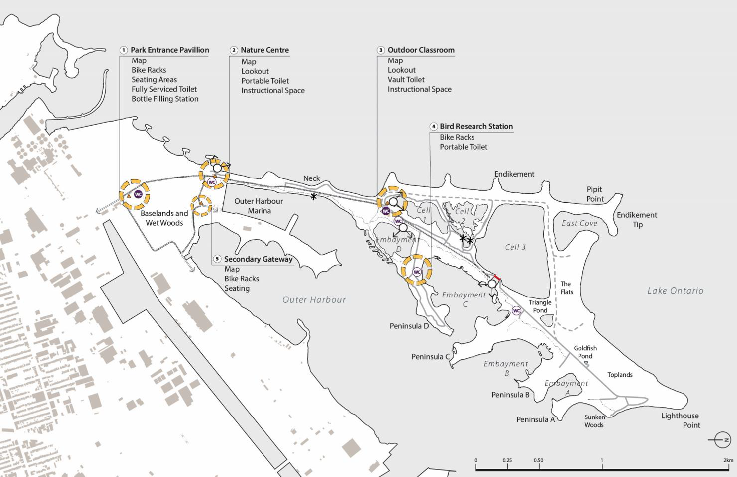
Tommy Thompson Park and the Leslie Street Spit - Key Visitor Experience Amenities and Landmarks


